| |
Geography

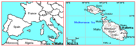
The Maltese archipelago consists of three inhabited islands, Malta, Gozo and Comino and two other uninhabited islands. They lie in the middle of the Mediterranean sea with Malta 93 km south of Sicily and 230 km north of North Africa.
Area:
total area: 316 square km (Malta 246, Gozo 67, Comino 2.7)
land area: 316 square km
Land bounderies:
0 km
Coastline:
140 km
Time:
Greenwich Mean Time plus 1 hour
Status:
republic
Main towns:
Valletta (Capital City): (estimated population 9,210)
Sliema: (estimated population 13,558)
Birkirkara: (estimated population 20,711)
Qormi: (estimated population 18,841)
Back to top
Climate
 The climate is warm and healthy. There are no biting winds, fog, snow or frost. Rain falls for only very short periods averaging about 578mm (20 inches) in a whole year. The temperature averages 14.1 °C in winter (November - April) and 32 °C in summer (May - October). The sun shines for an average 6.46 hours each day in winter and 10.11 hours in summer. The hottest period is from mid-July to mid-September. The island is seldom too hot even in the height of summer days and nights are regularly tempered by cool breezes from the sea. The climate is warm and healthy. There are no biting winds, fog, snow or frost. Rain falls for only very short periods averaging about 578mm (20 inches) in a whole year. The temperature averages 14.1 °C in winter (November - April) and 32 °C in summer (May - October). The sun shines for an average 6.46 hours each day in winter and 10.11 hours in summer. The hottest period is from mid-July to mid-September. The island is seldom too hot even in the height of summer days and nights are regularly tempered by cool breezes from the sea.
Back to top
Malta
 The longest distance in Malta from south-east to north-west is about 27 km and, at its widest point in an east-west direction, measures 14.5 km. The longest distance in Malta from south-east to north-west is about 27 km and, at its widest point in an east-west direction, measures 14.5 km.
Malta has neither mountains nor rivers. The island is characterised by a series of low hills with terraced fields on the slopes.
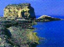
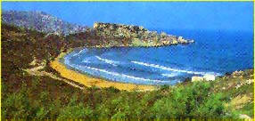
Malta's coastline has many harbours, bays, creeks, sandy beaches, and rocky caves. The length of Malta's shoreline is 137 km.
Population: 379,563(1998)
Capital: Valletta
Main Seaport: Grand Harbour - Valletta
Airport: Luqa (6 km from Valletta)
Back to top
Gozo
Gozo, the island of the nymph Calpso, is smaller than its sister island Malta and has a character quite distinct from it.
The countryside is greener and more spectacular. Flat-topped hills characterise the landscape whilst the coast has rugged cliffs, penetrated by steep valleys and beautiful bays. Gozo is more rustic and quieter than Malta. It is 14.54 km long anf 7.2 km at its widest point and its shoreline measures 43 km.
Population: 25,000
Capital: Rabat (Victoria)
Main Seaport: Mgarr
Heliport: at Xewkija
Back to top
Comino
Comino is the smallest island in the Maltese archipelago. Only a handful of farmers live there (about eight), no cars nor other noisy activities disturb the peace of this little paradise. There is only one cosy beach hotel. If you are in your element in or beside the sea, then Comino is ideal. The many bays and rocks in Comino and the crystal-clear waters are ideal for any kind of water-sports, especially snorkelling and diving. There is a regular ferry service to Malta and Gozo.
Back To Top
Statistics - Sunshine, Temperature and Rainfall
|
|
Month
|
Bright Sunshine
|
Rainfall
|
Temperature (in °C)
|
Sea
|
|
.
|
Hours
|
mm
|
Max.
|
Min.
|
°C
|
|
January
|
5.46
|
90.1
|
15.1
|
9.5
|
14.5
|
|
February
|
6.36
|
60.8
|
15.3
|
9.3
|
14.5
|
|
March
|
7.33
|
44.7
|
16.5
|
10.2
|
14.5
|
|
April
|
8.46
|
24.0
|
18.8
|
11.9
|
16.1
|
|
May
|
9.99
|
8.9
|
23.1
|
15.1
|
18.4
|
|
June
|
11.23
|
3.8
|
27.4
|
18.6
|
21.1
|
|
July
|
12.15
|
0.9
|
30.2
|
21.2
|
24.5
|
|
August
|
11.36
|
8.8
|
30.6
|
21.8
|
25.6
|
|
September
|
9.00
|
40.4
|
27.8
|
20.4
|
25.0
|
|
October
|
7.22
|
123.6
|
23.8
|
17.2
|
22.2
|
|
November
|
6.50
|
76.8
|
20.0
|
13.9
|
19.5
|
|
December
|
5.20
|
100.2
|
16.6
|
11.1
|
16.7
|
|
The table gives monthly averages taken over a period of 30 years for hours of bright sunshine, temperature and rainfall.
|
If you are looking for a custom decal or a decal that is out of production
or hard to find contact us and can produce this for you.
|


 The climate is warm and healthy. There are no biting winds, fog, snow or frost. Rain falls for only very short periods averaging about 578mm (20 inches) in a whole year. The temperature averages 14.1 °C in winter (November - April) and 32 °C in summer (May - October). The sun shines for an average 6.46 hours each day in winter and 10.11 hours in summer. The hottest period is from mid-July to mid-September. The island is seldom too hot even in the height of summer days and nights are regularly tempered by cool breezes from the sea.
 The longest distance in Malta from south-east to north-west is about 27 km and, at its widest point in an east-west direction, measures 14.5 km.